


villander

VacheKiri67
User
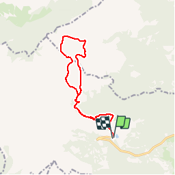

Length
13 km
Boucle
Yes
Creation date :
2019-08-01 08:18:28.534
Updated on :
2019-08-01 13:23:30.515
4h42
Difficulty : Medium

FREE GPS app for hiking
 SityTrail
IGN / Geographical institutes
SityTrail Plus
The world is yours!
About
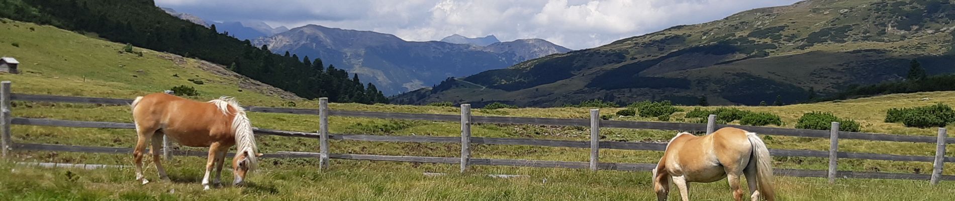
Trail Walking of 13 km to be discovered at Trentino-Alto Adige/Südtirol, South Tyrol, Villanders - Villandro. This trail is proposed by VacheKiri67.
Photos


39 photos in total. Please click on a photo to see them all in the gallery.
Positioning
Country:
Italy
Region :
Trentino-Alto Adige/Südtirol
Department/Province :
South Tyrol
Municipality :
Villanders - Villandro
Location:
Unknown
Start:(Dec)
Start:(UTM)
690572 ; 5168333 (32T) N.
Comments